Discover Interesting Places in Iloilo Part 2


Planning a trip? Those who love to travel know the essence of all travel is about you and your enjoyment. Travelers know that the destination is a major part of planning a trip, experiencing and delving deeper into unfamiliar places, people and culture are paramount.
Expand your horizons and set your sight to the Philippines, an off the beaten path travel site! An undiscovered paradise made of thousands of islands and white sand beaches all around! A tiny dot in the map of the world, and yet a haven for travelers, backpackers, retirees and even passersby.
It offers awesome tourist attractions, magnificent beaches, hot spring resorts, colorful festivals, hundreds of scenic spots and world-class hotels and facilities. Not to mention the tropical climate, the affordable prices as well as the friendly and hospitable, English-speaking people! You will be glad you came, and we’re sure, you WILL come back for more FUN in the Philippines!
INTERESTING PLACES IN ILOILO
Iloilo Province is filled with many natural and cultural spots worth exploring. Picturesque beaches are scattered across the seafood rich waters of Northern Iloilo where the islands of Gigantes and Sicogon in Carles, Concepcion, and Ajuy beckon. Head over to the Southern Iloilo to find well-preserved marine sanctuaries and heritage sites in San Joaquin and Miagao and peaceful grey sand beach havens in Guimbal, Tigbauan, and Oton. For nature lovers, there are many refreshing waterfalls, hiking trails, and highland areas in Central Iloilo just waiting to be discovered. You can find these cool spots in Bucari, Leon, Igbaras, Janiuay, Calinog, and Lambunao. Read More: http://www.exploreiloilo.com/do/place/iloilo-province/
Baliguian Island


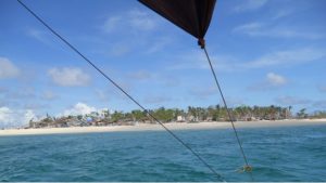
Baliguian Island (variously Baliguian Islet and unofficially called Miracle Island by the locals, due to its experiences with Typhoon Haiyan) is an inhabited island in northeastern Iloilo, Philippines. It is the westernmost of the Concepcion Islands and politically administered by the municipality of Concepcion. A virtually flat island, Baliguian features a lighthouse to aid in ship navigation.
Baliguian Island is 22.5 kilometers (14.0 mi) east of Panay Island in the Visayan Sea, making it the furthest of the sixteen Concepcion Islands. Baliguian is 14 kilometers (9 mi) due east of nearby Igbon Island. Small, flat, and heavily wooded, Baliguian is ringed by a narrow reef and surrounded by deep water.
The main feature of Baliguian is its lighthouse, situated on the northwest corner of the island. The Baliguian Island Light was built in 1916. Its designations are ARLHS PHI-007, Admiralty F2314, and NGA 14668. The white, octagonal tower is 66 feet (20 m) high and flashes a white light every seven seconds. The lighthouse is currently active and administered by the Philippine Coast Guard. Rainwater tanks were installed on Baliguian in 2010, as the island until then faced a constant shortage of potable water. Read More: https://en.wikipedia.org/wiki/Baliguian_Island
Bakwitan Cave
Bakwitan Cave is located on the northern part of Gigantes. “Bakwitan” means a place to evacuate in Ilonggo dialect. The cave is said to be the ‘refuge area’ to many locals during the war, and thus the name. Because of this reason why Bakwitan Cave has been of great archaeological importance. Many from the local community confirmed that there were several ancient coffins with mummified remains and burial jars in the area. Unfortunately, they were looted by treasure hunters. Trespassers also often to the place as reflected by various ugly vandals and graffitis that are found inside the cave – such a depressing sight.
Despite the unfortunate fate of mummified remains inside coffins and burial jars, despite the ugly vandals and other graffitis, Bakwitan Cave still offers an exciting experience. Some of its rock formations, stalactites, stalagmites, and columns are comparable to the ones in Palawan’s Underground River. It has a challenging trail that makes it a must-see area for adventurers. Read More: http://greedypeg.org/iloilo/Bakwitan-Cave.html
Bantigue Sandbar
Bantigue Island Sandbar is just 20 minutes of boat ride from Gigantes Norte. From Gigantes Norte, you will pass by an island perfect for cliff diving, and one that they call “Enchanted City” for its night lights courtesy of thousands of its host of fireflies.
During summer, the sandbar goes straight towards the sea. However, this ridge of sand is snake-like during monsoon season, and curves like a banana as the summer season approaches. All of these forms are defined by the action of the waves or currents. At times, when the water is really low, the sandbar is too long and the end of it almost reaches the island next to it.
The best time to visit Bantigue Island and appreciate its sandbar is during low tide so you get to see the sandbar in full. Read More: https://obotology.wordpress.com/2015/01/20/iloilos-islas-de-gigantes-bantigue-island-sandbar/
Go To Part 1 – 2 – 3 – 4 – 5 – 6 – 7 – 8 – 9
TABLE OF CONTENTS
Have a Taste of Iloilo’s Culinary Specialties
Where is Iloilo and How to Get There
Discover Interesting Places in Iloilo
Join the Vibrant and Exciting Festivals of Iloilo
Have a Feast of Good Foods in Iloilo
Enjoy a Lot of Fun Times in Iloilo
Iloilo Video Collection
Recent Posts
Have a Splash at the Laswitan Falls and Lagoon
LASWITAN FALLS AND LAGOON Photo from: https://www.sarwrites.com/2017/01/laswitan-lagoon.html The Laswitan Falls and Lagoon…
Cagpangi / Green Falls Lies in the Deep Medieval Forest
CAGPANGI / GREEN FALLS Photo from: https://www.solitarywanderer.com/the-green-falls/ Just about 16 kilometers…
Lanuza Surfing Grounds is a Remote Surfing Destination
LANUZA SURFING GROUNDS Photo from: https://www.surf-forecast.com/breaks/Lanuza-Rivermouth Lanuza in Surigao del Sur is…
Cagwait Beach is Often Compared to Boracay
CAGWAIT BEACH Photo from: https://www.pinterest.ph/pin/367043438355829159/ Cagwait White Beach Resort is formerly known…
Cabgan Island is Waiting to be Discovered
CABGAN ISLAND Photo from: https://en-gb.facebook.com/BaroboSurigaoDelSur27/posts Cabgan Island (or just Cabgan), is the…
Discover the Mystery of the Enchanted River
ENCHANTED RIVER Photo from: https://www.atlasobscura.com/places/hinatuan-enchanted-river Enchanted River is as mysterious as its…