Mt. Isarog National Park – Nature’s Refuge
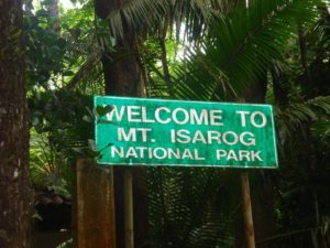
MT. ISAROG NATIONAL PARK


Mt. Isarog is a stratovolcano and is 1,966 meters above sea level. Located in Camarines Sur, Philippines, Mt. Isarog is considered as Southern Luzon’s highest forested peak. This is the site of Mt. Isarog National Park. Six municipalities and a city have territorial jurisdiction of Mt. Isarog National Park. These are Calabanga, Tinambac, Ocampo, Tigaon, Goa, Pili, and Naga City.
Mountain climbers and backpackers will enjoy trekking on Mt. Isarog’s slopes for a nature adventure. The best time to visit Mt. Isarog National Park is during the dry months of January to April. The temperature may be hot in the lowlands but it is cold and refreshing up in mountain’s forest.
Going to Mt. Isarog National Park’s summit is an eight to ten hour hike from Barangay Penicuason. This Penicuason trail leads to six campsites situated at various elevations. Bringing your own drinking water up to Camp One is a must. The clean streams and refreshing waterfalls can be the source of the hiker’s drinking water for the trip from Camp One going up to Camp Six. Read More: http://www.philippinesinsider.com/luzon/nature-adventure-at-mt-isarog-national-park/


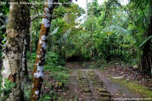
Mt. Isarog in Camarines Sur is 20 km east of the municipality of Naga and 420 km south of Manila. In 1938, it was proclaimed as a national park under the protection of Department of Environment and Natural Resources with partnership with the European Union for the Conservation of Nature. It has a total area of 10,112 ha. The park serves as refuge to endemic flora and fauna, waterfalls and to the indigenous Agta tribes. Among the waterfalls found in the area, the 13 m Malabsay Falls is the most popular, with its magnificent waterfall and enchanting lagoon. Within the slope of gorge are beautiful rare floras and neon colored dragonflies fluttering around the lagoon. The elevation of the mountain reaches at 1,976 meters above sea level. It serves as a haven to 1,300 species of floras including fascinating orchids, medicinal and flowering plants, hardwood trees, mosses, and ferns. There are also wild boars, deer, squirrels, monkeys and untamed rodents. A number of endemic animals also dwell here such as Mt. Isarog shrew mouse, Mt. Isarog Shrew rat, Isarog Shrew rat and the isolated forest frogs. .Also seen in the park is a wide diversity of birds; there are about 143 kinds of birds in which 15 of those are endemic. The park is considered to be the last Rainforest Mountain in Southern Luzon. Read More: http://www.visitphilippines.org/travelguide/mt-isarog-national-park/
Camarines Sur is blessed with a national park that qualifies as a perfect destination for nature lovers and backpackers. Located in the province’s geographic center, Mt. Isarog National Park is a cradle of rich diversity of flora and fauna and serves as a habitat for endemic species like the Isarog Shrew Mouse.
The adventure in the national park starts with the PanicuasonTrail located in Brgy. Panicuason, Naga City. It is an 8-10 hour hike leading to the summit that affords a spectacular scenic view of a large portion of CamSur.
Considered as one of the must-see natural wonders of the national park, the Malabsay Falls has ice cold water and a perfect spot for a picnic.
After its last eruption in 1641, Mt Isarog was named as a stratovolcano, a reason for the number of hot springs that can be found in its vicinity. One of which is the Panicuason Hot Spring Resort. Read More: http://www.choosephilippines.com/go/mountains-and-volcanoes/73/last-tropical-rain-forest-mt-isarog
TABLE OF CONTENTS
Camarines Sur – Rice Granary of the South
Where is Camarines Sur and How to Get There
Tourist Attractions in Camarines Sur
Watch The Exciting Festivals in Camarines Sur
How to Have Fun in Camarines Sur
Camarines Sur Video Collection
Other Visitors Also Viewed
Join the “Wet ‘n Wild” Regada Water Festival in Cavite
Pulacan Falls and Its Diverging Streams
Relax at the Secluded Hidden Valley Springs Resort in Laguna
Macahambus Cave in Cagayan de Oro
Amazing Beaches in Ajuy Iloilo
Bonbon Beach – Most Beautiful Beach in Romblon Island
Banga Festival Honors the Humble Clay Cooking Pot
Recent Posts
Have a Splash at the Laswitan Falls and Lagoon
LASWITAN FALLS AND LAGOON Photo from: https://www.sarwrites.com/2017/01/laswitan-lagoon.html The Laswitan Falls and Lagoon…
Cagpangi / Green Falls Lies in the Deep Medieval Forest
CAGPANGI / GREEN FALLS Photo from: https://www.solitarywanderer.com/the-green-falls/ Just about 16 kilometers…
Lanuza Surfing Grounds is a Remote Surfing Destination
LANUZA SURFING GROUNDS Photo from: https://www.surf-forecast.com/breaks/Lanuza-Rivermouth Lanuza in Surigao del Sur is…
Cagwait Beach is Often Compared to Boracay
CAGWAIT BEACH Photo from: https://www.pinterest.ph/pin/367043438355829159/ Cagwait White Beach Resort is formerly known…
Cabgan Island is Waiting to be Discovered
CABGAN ISLAND Photo from: https://en-gb.facebook.com/BaroboSurigaoDelSur27/posts Cabgan Island (or just Cabgan), is the…
Discover the Mystery of the Enchanted River
ENCHANTED RIVER Photo from: https://www.atlasobscura.com/places/hinatuan-enchanted-river Enchanted River is as mysterious as its…
