Archive for the ‘Kalinga’ Category
NATURAL ATTRACTIONS IN KALINGA
Sungang View Point
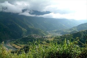 Photo from: http://greedypeg.org/kalinga/Sungang-View-Point.html
Sungang View Point – the viewpoint affords a majestic view of the valleys villages and mountains of Tinglayan, Tanudan, Tabuk and Lubuagan. A very good view of the Tulgao and Dananao Rice Terraces can be seen at the view point.
Palan-ah Falls and Hot Springs
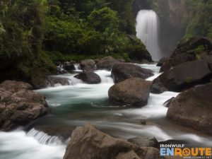 Photo from: https://www.ironwulf.net/2014/02/12/kalinga-trek-tulgao-palan-ah-falls-hot-spring/
Palan-ah falls and hotsprings – this waterfalls is located at Tulgao West, Tinglayan. The name is derived from the native term “Pinalpallang-ah” which means chair. The falls spray down from approximately 100 meters above forming a pool where during a sunny day, one practically swims at the end of the rainbow.
Mt. Mating-oy Dinayao
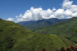 Photo from: https://greedypeg.org/kalinga/Mount-Mating-oy-Dinayao-Sleeping-Beauty.html
Mt. Mating-oy Dinayao (Sleeping Beauty)- these fabled mountain ranges border the municipalities of Tinglayan and Tanudan and they take the form of a sleeping lady supinely lying its back. A vantage view of the profile can be seen from the Sungang view or from Basao.
Tinglayan Rice Terraces
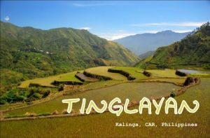
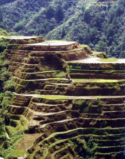
Tinglayan Rice Terraces – from the Sungang View Point, the Dananao and Tulgao Rice Terraces can be viewed. These rice terraces are like an amphitheater along the whole mountain slopes.
Lubo and Mangali Rice Terraces
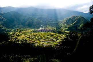 Photo from: https://triptheislands.com/destinations/discover-rare-finds-in-the-kalinga-province/
Lubo and Mangali Rice Terraces – the rice terraces surrounds the villages of Lubo. The best time to view the rice terraces is during the planting season and when the rice terraces is already ready for harvest.
Mount Binaratan
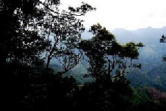 Photo from: http://julzryu.blogspot.com/2008/07/kalinga-tourism.html
Mount Binaratan – Mt. Binaratan is dubbed as the silent Mountain, it is the entry point of General Aguinaldo during his escape. Mt. Binaratan is the boundary between Mountain Province and Kalinga Province.The environment is comprised of dense, mossy jungles, where animals such as wild boars and deer roam, and where limatik (blood leeches) are a constant menace.
Mt. Binaratan according to legend, is the hunting ground of kabunyan “The Kalinga God”, Once upon a time when Kabunyan is hunting at Mt. Binaratan, the birds are too noisy that he can’t even hear the barking of his dogs and he lose sight of them.He then ordered the birds to keep quiet. Today Mt. Binaratan is popularly known as the silent mountain among the locals. – kalingatambayan.blogspot.com
Ugid Maling Subterranean River
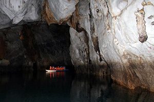 Photo from: https://greedypeg.org/kalinga/Ugid-Maling-Subterranean-River.html
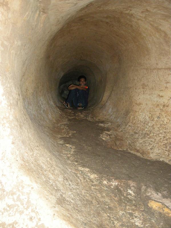
Ugid Maling Subterranean River – located four kilometers away from Poblacion, Balbalan and a good three and a half hours ride from the Capitol Town. It is a maze of cavernous boulders and rocks a top each other forming a cavern. – visitmyphilippines.com
Balbalasang National Park
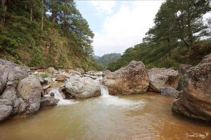 Photo from: http://www.traveltrilogy.com/2016/12/balbalasang-national-park-kalinga.html
Balbalasang National Park – this is a monument of the opposition of the Kalingas against the logging companies.
Buaya Caves
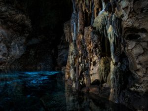 Photo from: https://maqotana.com/place/visit/buaya-caves
Buaya Caves – It is similar to Sagada Caves with stalactites and stalagmites formation. The caves are interconnected with each other and cover the whole mountain slope. – nscb.gov.ph
Bonnong Lakes and Asibanglan Lakes

Bonnong Lakes and Asibanglan Lakes – this is a mountain lake in Pinukpuk where eels thrive and can be recommended area for research. – skyscrapercity.com
Aguinaldo Hill
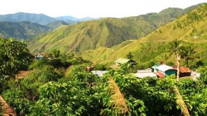 Photo from: https://maqotana.com/place/visit/aguinaldo-hill
Aguinaldo Hill – The Aguinaldo Hill is located at Barangay Asibanglan, Pinukpuk Road, Allaguia Junction in Kalinga Province. It was used by General Emilio Aguinaldo as a common post during the Philippine-American war. – wikipilipinas.org
Padcharao Lake

Padcharao Lake – the name is derived from the plants that abounds in the lake called “Chargo” in the Pasil and is located approximately from 1800 to 2000 meters above sea level.
The one-hectare Padcharao Lake, located 1,800 m. above sea level on Mt. Bannong, teems with Japanese eels. It was named after the charao plants that abound in the lake. The lake can be reached after a 4-hr. hike along the Tabia River. The jungle along the way has wild orchids and other wild flowers. – biyahero.net
Pasil Natural Dam
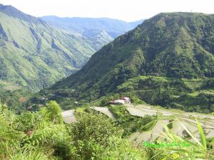 Photo from: https://maqotana.com/place/visit/pasil-natural-dam
Pasil Natural Dam – it is located at Puapo, Dangtalan and was formed after the mountain side eroded. It is ideal for boating and picnic site during the summer months. – localphilippines.com
Kabunian Bridge and Springs
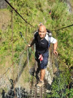 Photo from: weekendbackpacker.wordpress.com
Kabunian Bridge and Springs – these two natural landmarks are found in Maglucsad and Galdang respectively. – nscb.gov.ph
Guinaang Village
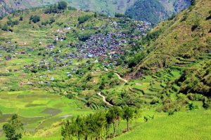 Photo from: https://anigorotodyssey.blogspot.com/2012/08/images-of-bontoc.html
Guinaang – this village has its historical importance to Kalinga as the retreat haven of President Aguinaldo. This is where the Headquarters were located and the campsite.
Mabilong Weavers Village
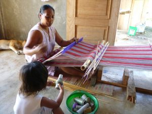 Photo from: http://kalingafornia-laga.com/mabilong-weavers.html
Mabilong Weavers Village – this is the center of the ethnic weaving industry in the province. The village is along the road and one can buy souvenirs right from the weavers.
Bananao and Manangol Viewpoint

Bananao and Manangol Viewpoint – this is along the road towards Tinglayan and on can have a panoramic view of the Chico River. – nscb.gov.ph
Elephant Hill
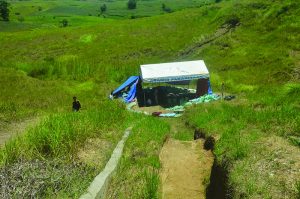 Photo from: https://www.zigzagweekly.net/archeological-rush-in-kalinga/
Elephant Hill – this is located in Rizal and is a site of an archeological digging where the other half of the remains of the elephant war was dug. – visitmyphilippines.com
TABLE OF CONTENTS
The Cordillera Administrative Region
Kalinga in the Cordillera Administrative Region
Colorful Festivals and Events in Kalinga
Natural Points of Interest in Kalinga
How to Have Fun in Kalinga
Other Visitors Also Viewed:
Lapay Bantigue Dance Festival Shows the Gracefulness of the Seagull
Swim in The “Amazingly Pink” Pink Beach of Northern Samar
Panhulugan Caves Inside the Sohoton National Park
Tultugan Festival – Bamboo Dance and Music
Kasag Festival in Celebration of the Blue Crabs
Porta Vega Powdery White Sand Beach Lined with Coconut Trees
Kalesayahan Festival Focuses on Decorated Horse-Drawn Carts
Inuruban Festival is a Celebration of the Town’s Favorite Foods
Cagnituan Falls and Cave – Double Experience, Twice the Fun
Bulubadiangan Island in Iloilo

