Posts Tagged ‘Mount Iriga’
Planning a trip? Those who love to travel know the essence of all travel is about you and your enjoyment. Travelers know that the destination is a major part in planning a trip, experiencing and delving deeper into unfamiliar places, people and culture is paramount.
Expand your horizons and set your sight to the Philippines, an off the beaten path travel site! An undiscovered paradise made of thousands of islands and white sand beaches all around! A tiny dot in the map of the world, and yet a haven for travelers, backpackers, retirees and even passersby.
It offers awesome tourist attractions, magnificent beaches, hot spring resorts, colorful festivals, hundreds of scenic spots and world-class hotels and facilities. Not to mention the tropical climate, the affordable prices as well as the friendly and hospitable, English-speaking people! You will be glad you came, and we’re sure, you WILL come back for more FUN in the Philippines!
TOURIST ATTRACTIONS
Want to experience a unique holiday? Camarines Sur in the Philippines will surely provide travelers with one-of-a-kind experiences. CamSur, as it is called by the locals, boast rich natural attractions plus cultural and heritage vestiges that make for an exciting vacation. Read More: http://triptheislands.com/travel-tips/10-must-see-places-in-camarines-sur-for-a-unique-vacation-experience/
Mt. Isarog National Park
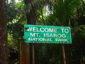 Photo from: https://jennysserendipity.com/2012/05/16/hiking-up-to-mt-isarog-malabsay-falls/
Mt. Isarog is a stratovolcano and is 1,966 meters above sea level. Located in Camarines Sur, Philippines, Mt. Isarog is considered as Southern Luzon’s highest forested peak. This is the site of Mt. Isarog National Park. Six municipalities and a city have territorial jurisdiction of Mt. Isarog National Park. These are Calabanga, Tinambac, Ocampo, Tigaon, Goa, Pili, and Naga City.
Mountain climbers and backpackers will enjoy trekking on Mt. Isarog’s slopes for a nature adventure. The best time to visit Mt. Isarog National Park is during the dry months of January to April. The temperature may be hot in the lowlands but it is cold and refreshing up in mountain’s forest.
Going to Mt. Isarog National Park’s summit is an eight to ten hour hike from Barangay Penicuason. This Penicuason trail leads to six campsites situated at various elevations. Bringing your own drinking water up to Camp One is a must. The clean streams and refreshing waterfalls can be the source of the hiker’s drinking water for the trip from Camp One going up to Camp Six. Read More: http://www.philippinesinsider.com/luzon/nature-adventure-at-mt-isarog-national-park/
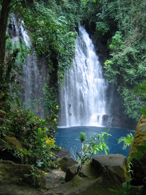
Itbog Twin Falls
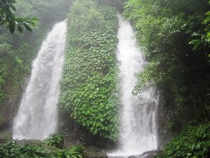 Photo from: http://crazyweirdnormalguy.blogspot.com/2012/01/buhi-camarines-sur-itbog-falls-muddy.html
Camarines Sur is one province in the Bicol Region that offers a variety of natural attractions. From its pristine beaches (think Caramoan) to its stunning mountains (imagine Mount Isarog and Mount Asog) and relaxing lakes (Buhi, Bato and others), adventure possibilities seem endless.
And there is more to these natural wonders… One should miss out some of the province’s waterfalls. Case in point, Itbog Twin Falls – an almost 60-feet, almost identical waterfalls cascasding from atop Mount Asog. This not-so-known wonder of nature is tucked in the thriving vegetation of Buhi town. Together with Lake Buhi, Mount and Asog, Itbog serves as one of the town’s major attractions. Read More: http://greedypeg.org/camarines-sur/Itbog-Twin-Falls.html
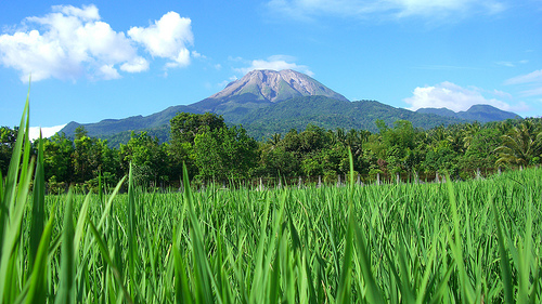
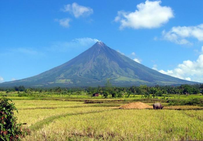
Mount Iriga / Mount Asog
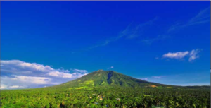 Photo from: http://dianamrtnz.blogspot.com/2014/08/mount-iriga.html
Mt. Asog has a colorful history. It was named after a ancient datu (chieftain) of the Agtas named Asog, who reigned over the region. Sometimes it is also called Mt. Sumagang, which means “Mountain of the Rising Sun”. In some lowland areas, the sun seemingly rises from the mountain itself. Being on the eastern side of Luzon, the sun rises majestically from the Pacific Ocean when viewed from its summit. Read More: http://www.pinoymountaineer.com/2007/09/mt-asog-1140.html
Culapnitan Cave
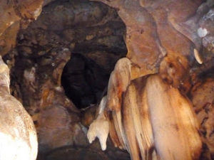 Photo from: http://phvacation.blogspot.com/2013/06/camarines-sur.html
Calupnitan Cave has one of the most magnificent stalactite formations in its interiors. The caves contain countless stalagmites, stalactites, and pillars ranging from massive to delicate. Millions of bats emerge wildly from these caves, a rare but fearsome spectacle. Read More: http://phvacation.blogspot.com/2013/06/camarines-sur.html
Libmanan Caves National Park
 Photo from: http://snipview.com
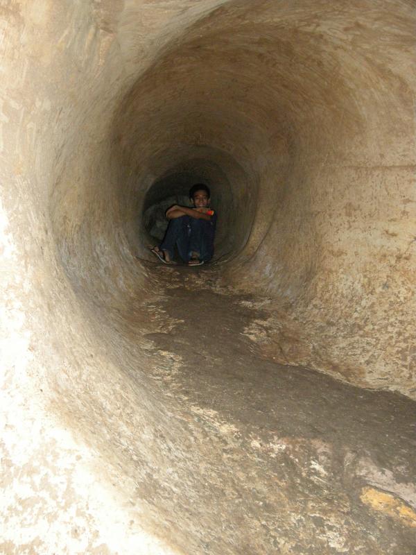
Libmanan Caves National Park is a protected area of the Philippines located in Barangay Sigamot in the municipality of Libmanan, Camarines Sur in Bicol Region. It is centered on the massive 2,856 meter-long Colapnitan Cave, the tenth longest cave in the Philippines. The park itself covers a total area of 19.4 hectares across the hilly farmlands of Libmanan, known to host at least 18 more limestone caves of varying lengths, shapes and wonder.
The park is famous as the habitat of thousand of bats whose guano has been gathered from the cave for decades. It is also home to swiftlets and some great long-armed spiders of the species that are known to be poisonous. Read More: https://en.wikipedia.org/wiki/Libmanan_Caves_National_Park
Atulayan Island
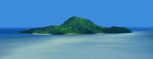 Photo from: http://www.philpar.com/2017/02/atulayan-island-travel-guide-sagnay.html
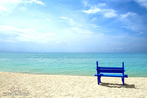
Atulayan Island in Camarines Sur may not be a familiar beach destination but it is never short of that blissful island indulgence beach bums look for. It lies on the district of Partido Riviera, that side of Bicol where the land, sea and sky meet.
Atulayan is a snail-shaped island blessed with 4 coves edged by fine white sand. There are no resorts and no beach parties, but there are plenty of open spaces for solitude. There are no secrets in Atulayan, but those who have come discovered a lot. Read More: http://www.philippinebeaches.org/atulayan-island-camsur-photos/
Lake Buhi
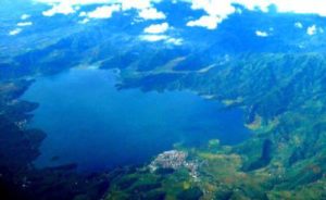 Photo from: https://paulorivera93.wordpress.com/2014/08/17/lake-buhi-camarines-sur-philippines/
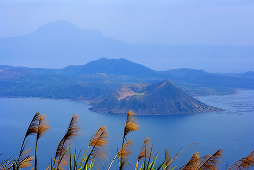
Lake Buhi is a lake found in Buhi, Camarines Sur in the Philippines. It has an area of 18 square kilometers (6.9 square miles) and has an average depth of 8 meters (26 ft). The lake lies in the valley formed by two ancient volcanoes, Mount Iriga (also known as Mount Asog) and Mount Malinao. It was created in 1641, when an earthquake caused a side of Mount Asog to collapse. The resulting landslide created a natural dam that blocked the flow of nearby streams. Another theory suggests that it was created by the eruption of Mt. Asog, which is now dormant.
The lake is famous since it is one of the few bodies of water that contains the sinarapan fish which is the world’s smallest commercially harvested fish. Read More: https://en.wikipedia.org/wiki/Lake_Buhi
Gota Beach
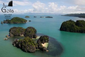 Photo from: http://philippinehospitality.blogspot.com/2012/02/gota-village-resort-caramoan.html
Gota Beach Resort is the top end resort in Caramoan recommended for those who don’t mind paying extra for a somewhat more luxurious beach escapade. It has its own beaches which are also open for the public so it is best to avoid it during weekend (Caramoan residents pay Php150 and php300 for non residents). In 2008, we stayed at this resort just because it was the only beach resort available at that time that had its own beach. A lot of the time, the beach is occupied by the crew of Survivor so it is often closed for public.
It is also quiet expensive to stay at this resort compared to other resorts in the area now but its location makes it all worth it. We actually spent most of our time on its beach and only visited the nearby Malarad Island during our stay. The resort is surrounded by towering limestone cliffs covered with green vegetation and it has two coves with fine sand, one of which is another jump-off point for island-hopping. It is a few minutes boat ride from Malarad Beach (formerly called Matukad Island), Lahus and Hunungan Beach Resort. Read More: http://www.lakwatseradeprimera.com/caramoan-accommodation/
Rose or Aguirangan Island
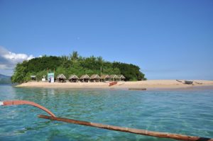 Photo from: http://www.tripmondo.com/philippines/bicol/maagnas/
It is located at Lagonoy Gulf in Maangas Presentacion Camarines Sur. There are two options on how to reach this island. First is from Sabang Port going to San Jose and all the way to the island(by boat). And you can also go there by means of any land transportation taking Peninsula road via Lagonoy to Presentacion. In here you can enjoy kayaking and snorkeling with your love ones or bonding with your family. Clear and clean water where you can enjoy your swimming activity.You can enjoy your overnight stay because it has complete amenities but very affordable prices. Read More: http://noeldbueza.blogspot.com/
Go To Page 1 – 2 – 3
TABLE OF CONTENTS
Camarines Sur – Rice Granary of the South
Where is Camarines Sur and How to Get There
Tourist Attractions in Camarines Sur
Watch The Exciting Festivals in Camarines Sur
How to Have Fun in Camarines Sur
Camarines Sur Video Collection
Other Visitors Also Viewed
Join the “Wet ‘n Wild” Regada Water Festival in Cavite
Pulacan Falls and Its Diverging Streams
Relax at the Secluded Hidden Valley Springs Resort in Laguna
Macahambus Cave in Cagayan de Oro
Amazing Beaches in Ajuy Iloilo
Bonbon Beach – Most Beautiful Beach in Romblon Island
Banga Festival Honors the Humble Clay Cooking Pot

