Posts Tagged ‘must-see places in Cotabato’
BEST PLACES IN SOUTH COTABATO
NOTE: North Cotabato (or Cotabato), Cotabato City and South Cotabato are NOT the same.
Bakngeb River Cave
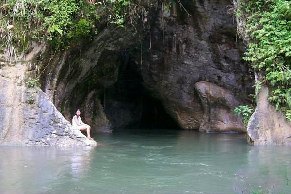 Photo from: https://www.mylifewithphotographs.com/2016/04/river-cave-in-bakngeb-laconon.html
Bakngeb has a wide river pool in its outlet that visitors can swim in. Its underground cave system makes the water naturally cold and crystal clear.
Bakngeb is also a habitat for nocturnal creatures such as bats which can be seen clinging to the cave’s natural rock formations.
Aside from exploring the cave and swimming in its pool, water tubing and river rafting are two activities that you can also enjoy when you visit Bakngeb. Read More: https://www.choosephilippines.com/go/water-forms/4233/bakngeb-cave-tboli-south-cotabato
Cresta Del Rio Splash Resort
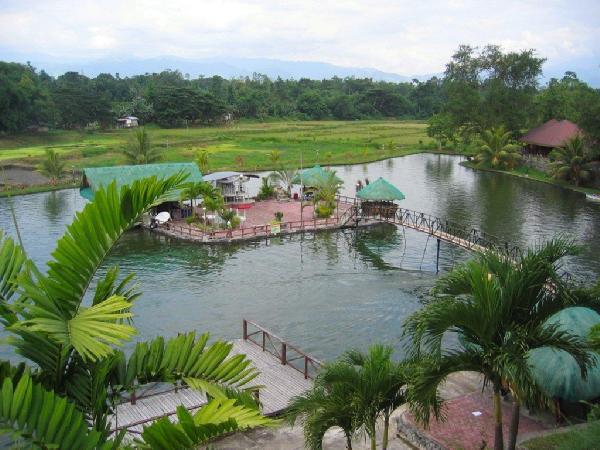 Photo from: http://jzyle-delriosplashresort.blogspot.com/
Cresta Del Rio Splash Resort is just 5km away from Koronadal City proper, it offers quality and modern recreational and catering facilities, at reasonable price such as: swimming pools with slides for adults and children, pool cottages, restaurant pavilion for pool side events, function hall for various catering needs which can accommodate 400-500 persons. Read More: https://www.facebook.com/Cresta-Del-Rio-Splash-Resort-314196628946447/
DOLE Plantation
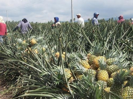 Photo from: https://www.freshplaza.com/article/2120256/philippines-dole-to-expand-plantation-area-to-meet-new-markets/
Dole operates a fully integrated pineapple plantation and industrial facility in Polomolok, South Cotabato, Philippines.
Fruit is sourced from a Dole-operated base plantation as well as from third party growers. Besides the operations in Polomolok, Dole also has fruit processing operations in Surallah in South Cotabato and Calumpang in General Santos City.
The product offerings comprise a variety of processed pineapple products such as slices, chunks, tidbits, crushed, juice, frozen and concentrate. In addition, Dole runs a fresh pineapple operation where once fruit is harvested, it is shipped to many parts of the world. Read More: https://www.doleasia.com/our-farms/philippines-pineapple
GenSan City Fish Port
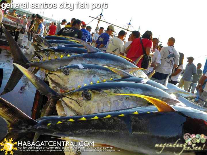 Photo from: https://www.choosephilippines.com/do/buy-local/521/General-Santos-Fish-Port
General Santos City Fish Port is located 15 kilometers south of downtown GenSan, just right at the coast of Sarangani Bay. It was constructed with the aid of the Japanese (the biggest importer of tuna from GenSan) to construct what will be one of Philippines’ most modern and largest port devoted to fisheries.
Every early morning, large fishing bancas (boats) unload their catch from the Pacific and Celebes Seas (sometimes it may take them days or months to be in the middle of the sea) in the Fish Port. Loads of cargadores (or carriers) of tuna, sometimes as big as a man, is unloaded, weighed, and graded in Market 1 of the Fish Port. It is the best time to watch, observe, and even appreciate how the Generals have moved its once “backwater country” into one of Philippines’ premiere cities.
Take note though that even though it is a fish port and a market, the authorities here promote a high standard of cleanliness and safety–to comply with the international standards necessary for exporting tuna to the world. That is why, when you go there, no shorts allowed–and you got to wear some boots, and take a foot bath before entering. Read More: https://www.choosephilippines.com/do/buy-local/521/General-Santos-Fish-Port
Kalaja River
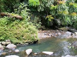 Photo from: https://mapsights.com/general-santos-city/clear-waters-of-kalaja-river/85628486
Klaja is located 15km at the North East side of General Santos City, at Barangay Conel, Kalaja Karsts Land derived her name from “el Klaja” which means water that or river that zigzags in its coast, and due to the surrounding towers of karsts formation made millions of years ago. It produced waterfalls and caves and opposite to this area is the Ranch (camping ground) of Nopol Hills which borders Conel and Brgy. Mabuhay. The place also offers wide view of Gensan, Sarangani Bay and some parts of South Cotabato and Sarangani Province.
During World War II, Gen. Santos City become one of the last bastion between the American and Japanese forces. Japanese retreating forces made Kalaja Karsts Land as their last ground for defenses, constructing round cemented bunkers and tunnels. Read More: http://klaja.blogspot.com/2007/03/location-of-klaja.html
Lake Holon
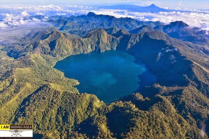 Photo from: http://www.thechroniclesofmariane.com/2014/03/love-at-first-sight-at-lake-holon-tboli.html
Lake Holon, also known locally as Lake Maughan, is located in the Municipality of T’boli, Province of South Cotabato, Southern Mindanao. As I have researched more about it, Lake Holon is actually a crater of a stratovolcano named Mt. Parker, locally known as Mt. Melibingoy, and that explains the steep trail I didn’t expect! Mt. Parker is the highest peak among the 15 mountain ranges surrounding Lake Holon, with a height of 1,824 masl. Read More: http://www.arrenwanders.com/breathtaking-lake-holon-of-tboli-south-cotabato/
Lake Sebu
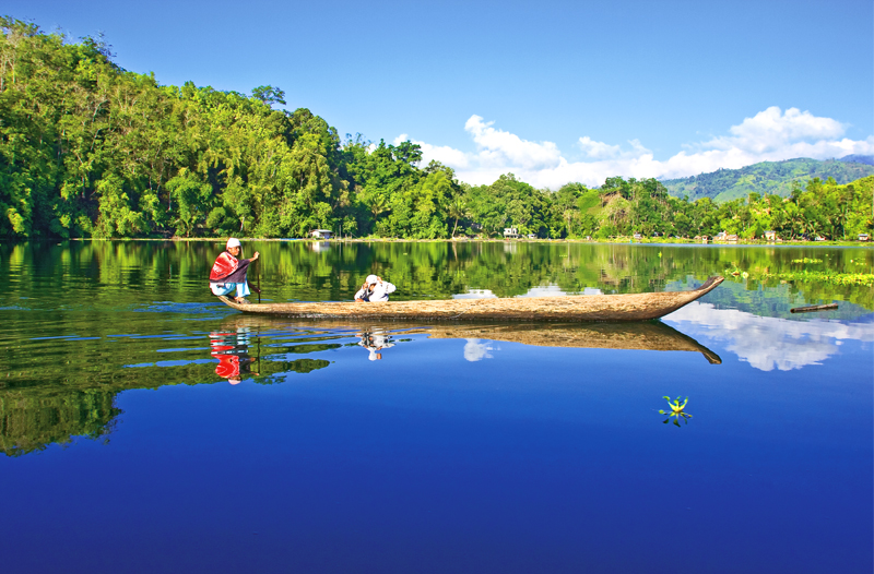 Photo from: https://www.phtourguide.com/lake-sebu-south-cotobato/
Lake Sebu is a 2nd class municipality in the province of South Cotabato. The economy of Lake Sebu is based on aquaculture of tilapia grown in large fish cages floating in the lake. More than one half of the land around the lake is cultivated for agriculture. It also promoted as an eco-tourism destination.
It is the most visited among the tourist destinations that can be found in South Cotabato. This municipality is rich in natural scenic spots, luxuriant nature, and a well-preserved culture of the indigenous people still living there. It attracts lots of tourist in and out of the country. It is known for having seven amazing cascades of water that are lined up one after the other, plus 3 lakes. Lake Sebu is surrounded by rolling hills and mountains covered with thick rainforests. Around the lake, wild boars and Philippine Deer that are considered endangered are living. The rainforest in the mountains and lakes are also a natural habitat to egrets, kingfishers, swallows, herons, Philippines cockatoos, and kites. Read More: https://www.vigattintourism.com/tourism/articles/Lake-Sebu-A-Nature-Lovers-Dream-Destination
Lang Dulay T’nalak Weaving Center
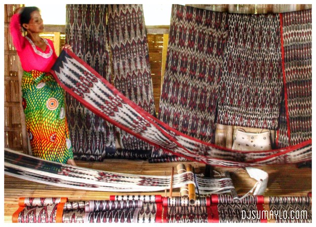 Photo from: https://djsumaylo.com/2015/01/19/who-is-lang-dulay/
Lang Dulay was a T’boli native famous for her T’nalak, a type of manually woven tapestry using abaca fiber. Her unique designs, which were said to be inspired by dreams, won her a National Folk Artist recognition. Sadly, we didn’t get to see her weave her dreams into hypnotic red and black patterns in person as she passed away short of a year before we visited. Her tomb can be visited on a humble plot of land, right beside her house. Read More: https://www.lakadpilipinas.com/2016/04/lake-sebu-day-tour.html
Mariano’s Blooming Agri-Tourism Park
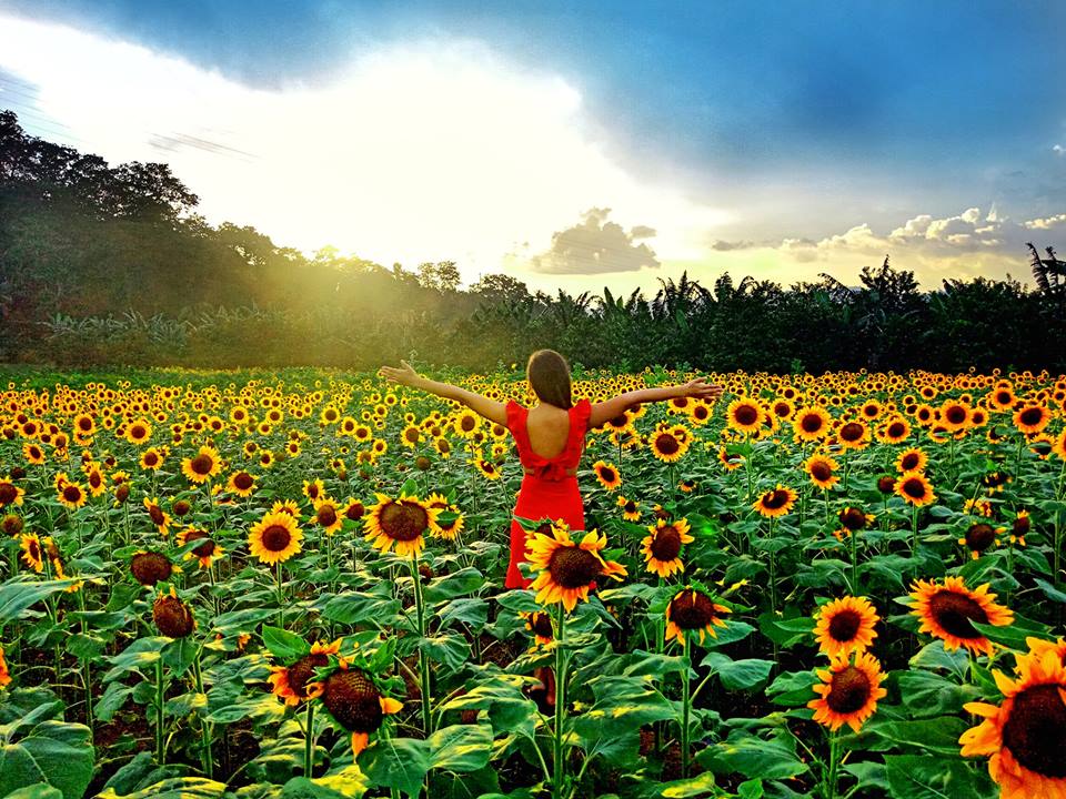 Photo from: http://gorgeousgeorgy.blogspot.com/2018/11/marianos-blooming-agri-tourism-park_1.html
Put some sunshine in your life and experience the beauty of the very first Agri-Tourism Park in South Cotabato, the Mariano’s Blooming Agri-Tourism Park.
With a minimum entrance fee of Php 70 for adults and Php 50 for children, you can wander in the park, take a selfie, or a have a photo with your friends and family with the beautiful sunflowers as your backdrop.
The park is open from Monday to Sunday from 8:00 a.m. to 9 p.m.
Hungry after your walk? You can also dine in their newly opened Mirasol Café. Mariano’s Blooming Agri-Tourism Park is a DOT-Accredited establishment of the SOX region. They are located at Purok 3A, Tupi, South Cotabato.
For inquiries you may contact them through their page at Mariano’s Blooming Agri-Tourism Park or through this number 0975 006 3772. Read More: https://www.facebook.com/DOTXII/posts/marianos-blooming-agri-tourism-parkput-some-sunshine-in-your-life-and-experience/1169071456558739/
Mount Matutum
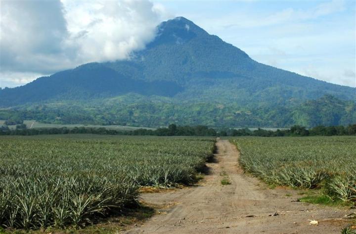 Photo from: http://thingsasian.com/story/mt-matutum-true-gift-mother-nature
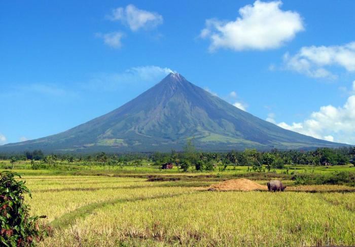
Mount Matutum is situated in Tupi, South Cotabato. It is an active volcanic mountain with an elevation of 2,286 meters above the sea level. The last recorded eruption of this mountain was in 1911. The shape of this mountain is like Mount Mayon, symmetrically conical which was molded by the last eruption activities, but it is not a perfect cone.
Mount Matutum hosts a variety of flora and fauna which is composed of 110 plant species and 57 animal species. It is a home of tropical and rare species of birds, including the rarest, tallest, largest and most powerful birds in the world, the Philippine Eagles (Pithecophaga jefferyi) or the monkey-eating eagles, that have been lined-up as endangered. There are also bleeding heart pigeons, the Negros fruit doves which are almost extinct, barblers, warblers, doves, bulbuls, woopeckers, and snowy brown flycatchers. The locals also see tarsiers, the world’s smallest monkeys, in the place and researchers have conducted a one-year study on this animal – their population size, distribution, density, habitat, and status in the place. Read More: https://www.vigattintourism.com/tourism/articles/Mount-Matutum
Paraiso Verde Resort and Water Park
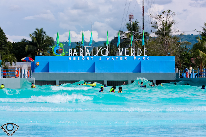 Photo from: http://boyetstour.blogspot.com/2012/11/paraiso-verde-resort-and-water-park.html#.XWU7H3t7laQ
Paraiso Verde Resort and Water Park operates the first and only wave pool in the region. It also features a 400-gallon giant bucket that empties into the wave pool, and a 600-square-meter kiddie pool with smaller buckets and slides.
South Cotabato is a landlocked province but with this water park around, you no longer have to travel far just to get your fix of beach fun. Read More: http://southcotabato.gov.ph/tourism/water-acitivities/
Seven Falls
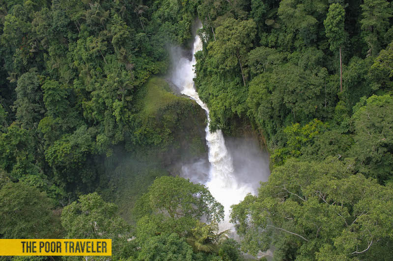 Photo from: https://www.thepoortraveler.net/2013/12/7-falls-zipline-tallest-lake-sebu-philippines/
Already blessed with dozens of lakes, Barangay Seloton of the Municipality of Lake Sebu, South Cotabato, has natural attractions that are must-see for waterfalls fanatics: Seven Falls. Concreting of access road paved the way to the booming of tourism of these natural wonders for the town. Imagine, not only one, but SEVEN magnificent waterfalls are waiting for you there. Read More: http://www.tupanggala.com/seven-falls/
Surallah Tri-People Monument
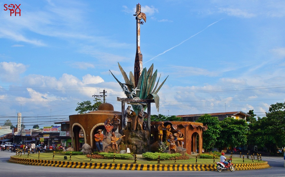 Photo from: https://www.soxph.com/2016/03/tri-people-monument-in-surallah.html
Surallah is located in the Allah Valley; an agro-industrial municipality that has once been branded as Cleanest Municipality. It has 17 barangays and Lake Sebu was also once a barangay member of this municipality until some changes in 1991.
There are many structures within the area where you can see gigantic structures of T’boli and B’laan, their musical instruments and their produce.
Another part of the rotunda is the waiting shed, where many bystanders can wait for buses or rest for a while after their transactions in the Municipal Hall which is just a few steps away from the structure. There is also a small park located just across the municipal hall where there are vendors and a cool grassfield to enjoy. Read More: http://sdumalay.blogspot.com/2012/03/famous-cultural-landmark-in-surallah.html
T’boli Museum
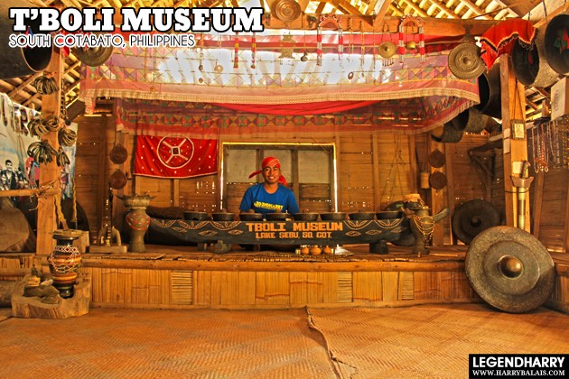 Photo from: http://harrybalais.com/2013/02/the-tboli-museum-in-lake-sebu-south-cotabato/
Stop by and visit the T’boli Museum when you’re in Lake Sebu.
T’Daan Kini Falls
T’daan Kini Falls is situated at Barangay Lamlahak. About 10 minutes drive from the town proper; we proceeded to Sitio Talibu, the jump off site going to T’daan Kini Falls. To get to the falls, it requires a 45-minute trek passing through green ricefields, two flowing cold streams, green valleys and hills and other picturesque sceneries that made our trek truly stimulating. Read More: http://www.olanology.com/2011/04/tdaan-kini-falls-lake-sebus-newest.html
Tarsier Sanctuary
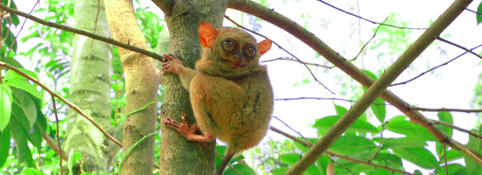 Photo from: https://southcotabato.gov.ph/wheretogo/linan-forest-parklinan-tarsier-conservation-sanctuary/
According to estimates, about 120 tarsiers are living in a 500-hectare habitat very close to a Blaan village. Since then, documenting the tarsier population has been ongoing but early estimates say it could be bigger than the tarsier population in the island of Bohol, where the primate is an icon.
In one village in South Cotabato alone, 19 tarsier habitats have been identified so far. Tarsiers are territorial creatures so there are usually only a couple of them living in one habitat. Specifically, the Tarsiers can be found in Barangay Linan, Tupi which has been turned into the Linan Tarsier Conservation Sanctuary, efforts are also underway to create the Tarsier Trail which will allow guests to view the Tarsiers from a safe distance without disturbing them. In the Linan Forrest Park one can experience trekking, camping and sightseeing at Linan’s series of waterfalls. Since their discovery by lumad residents in 2009, South Cotabato’s tarsiers have increasingly drawn attention among local tourists wanting to actually see the nocturnal creature. Read More: https://explora.ph/note/54/sunrise-view-at-the-tarsier-sanctuary-bio-diversity-corridor
TABLE OF CONTENTS
South Cotabato is a Part of REGION XII also known as SOCCSKSARGEN
South Cotabato and Its Strategic Location
Where is South Cotabato and How to Get There
Best Places to See in South Cotabato
Watch Colorful Festivals in South Cotabato
Let’s Have Fun in South Cotabato
South Cotabato Video Collection
Other Visitors Also Viewed:
Palani Beach Boasts of a 10 Km-Long White Sand Beach
San Isidro Labrador / Pahiyas Festival in Quezon
Colorful and Exciting Festivals in Nueva Ecija
Top Tourist Destinations in Aklan
Embajada Festival – a Re-Enactment of Christianization
Bird Watching at the Olango Wildlife Sanctuary
The Small Paradise in Agho Island in Iloilo
Sugbo Festival Honors the Humble Tiger Grass
Kabila / Kibila White Beach is Famous for Diving and Snorkeling
The Unspoiled Beauty of Aroroy Beach
Enjoy Spelunking and Swimming at Suhot Cave and Spring

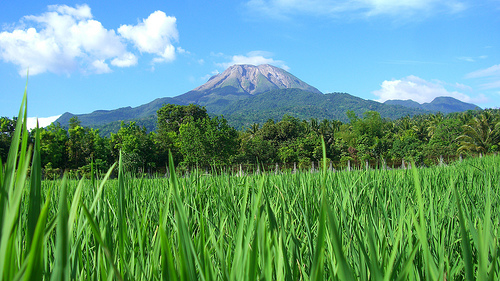
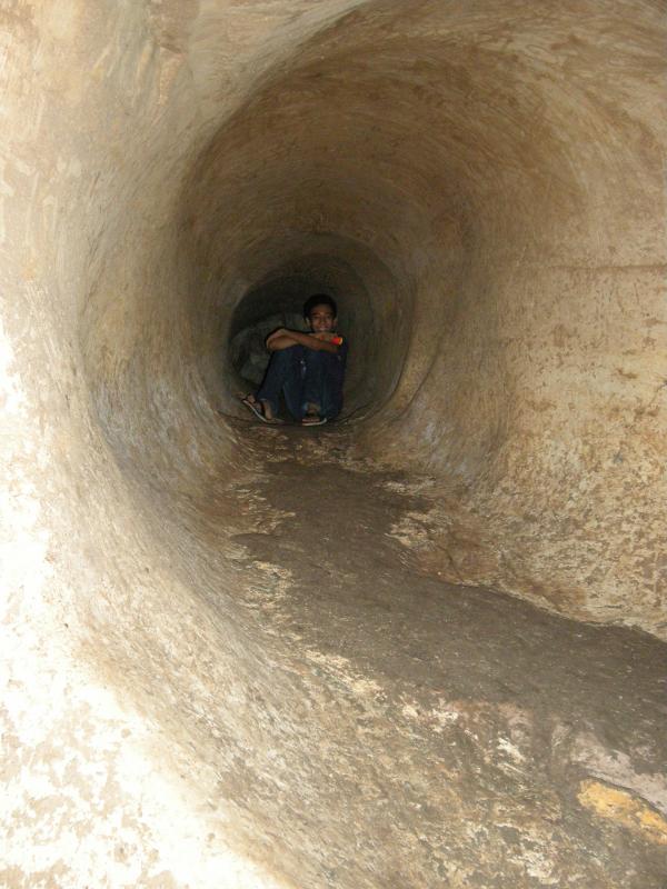


 Photo from: